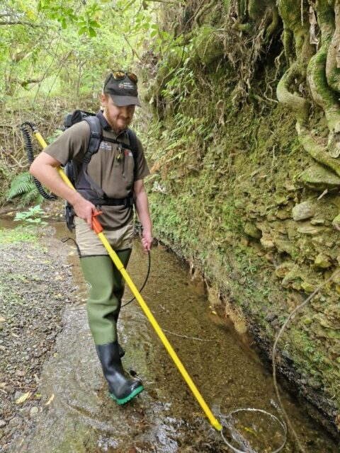
Camlo Carter-Ritchie
2024 recipient of the Dr Eileen Fair Environmental Studies Master’s ScholarshipResearch topic: Using fluvial geomorphology to frame room for the river in New Zealand’s dynamic gravel bed rivers
Cam’s research explores how granting rivers greater spatial freedom can restore their natural processes, advocating for a paradigm shift: instead of forcing rivers into human-defined constraints, we must align land use with their inherent fluvial potential.
Our rivers tell a story of constraint, with half their active channels lost to decades of rigid flood control engineering. These constrained rivers now struggle to adapt to climate change, revealing flaws in our resistance-based approach to river management. Cam’s approach prioritises long-term landscape dynamics over short-term fixes, recognising that traditional concepts like flood return periods are becoming obsolete in a changing climate.
Focusing on historically dynamic rivers in the Manawatū region, particularly the Oroua and Pohangina, Cam assessed the drivers and consequences of channel narrowing, evaluating how past management practices have disrupted fluvial processes. The devastating impacts of Cyclone Gabrielle provided a critical case study in how both hardened and flexible approaches behave under extreme stress. Using geospatial tools (historic maps, LiDAR, and satellite imagery), Cam looked to quantify changes in channel width and floodplain alterations, while field surveys validate reconstructions of pre-disturbance conditions. By integrating geomorphological analysis into his work, Cam aimed to quantify “room for the river” principles, which is a form of restoration that enhances ecosystem function, mitigates flood risks, and strengthens resilience.
This research contributes to global river rehabilitation efforts by bridging scientific theory with practical, real-world management. It critiques outdated methods (eg Henderson and Lacey equations) and looks to advance our understanding of system health, thresholds, and lateral connectivity between rivers, floodplains, and wetlands. The findings will provide evidence-based recommendations for balancing ecological rehabilitation with community flood protection needs, encouraging coexistence with dynamic riverine landscapes.
Ultimately, this work seeks to help redefine river management in Aotearoa while supporting sustainable adaptation to climate change. By contextualising New Zealand’s challenges within international restoration, Cam hopes to inspire more holistic, resilient approaches to living alongside rivers.
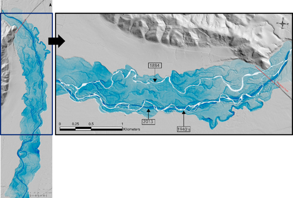
Waipoua River relative elevation model (REM) and georeferenced imagery. Reconstructions from historic maps show that the Waipoua river likely avulsed (changed course) some time after 1884. The 1884 channel is larger and more westerly than the 1940s channel (mapped from early aerial imagery). Cross-cutting relationships in the REM indicate the 1884 channel did not migrate to the 1940s position, with no prominent “workover” features (eg scroll bars) between them. Avulsion following aggradation and readjustment after the 8.2 Mw Wairarapa fault (red dotted line) ruptured likely drove the shift, preserving floodplain elements like medial bars and channels between the alignments.
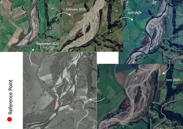
When Eileen Fair was born in 1936, New Zealand’s rivers looked strikingly different than they do today. After Cyclone Gabrielle struck in 2023, followed by severe floods in 2024, the Pohangina River reverted to a wandering course in some stretches, much like it had been in 1946.
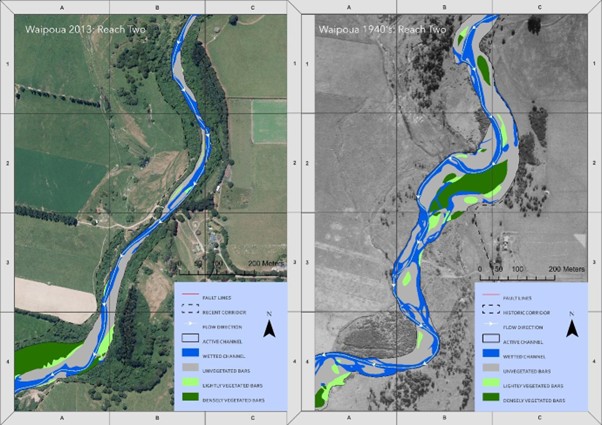
Example reach showing details of river corridor transformation between 1940 and 2013 and application Natural Character Index (NCI) for the Waipoua River, showing the ratio of change in a range of parameters used to define the character and composition of the river corridor (Fuller et al., 2020).
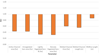
Natural Character Index (NCI) approach (Fuller et al., 2020) applied to the Waipoua River, indicates a ~50% reduction in area of the active channel corridor between 1943 and 2021.